Boyle ‘Dodged a bullet’ with severe storm
Published 8:09 am Friday, April 7, 2017
County was ‘in the bullseye,’ had multiple tornado warnings, but only minor damage
Despite ominous-looking clouds and predictions of potentially damaging weather, properties in Boyle County seemed to survive Wednesday’s storms with little damage, said Mike Wilder, Danville-Boyle County Emergency Management director.
“We really dodged a bullet according to what the weather service said … They were pretty well putting this part of Kentucky, central Kentucky, in the bullseye,” Wilder said. “There was no structure damage — none has been reported to dispatch and none has been reported to my office at this time.”
The National Weather Service was predicting much more damage for the area — and even called Wilder on Thursday to find out.
“They said they were coming out for a damage assessment and I said, ‘That would be fine, but there’s not any damage to assess.’ There were trees, but we get that every time we get something,” he said.
“It really did look bad for a while, and it was. It just kept continuing. You would think it was going to let up, but it just didn’t seem to do it — that’s why they kept issuing those tornado warnings,” he said.
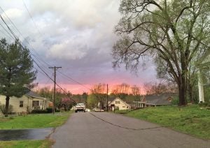
Photo courtesy of Perryville Fire Department
A power line leading to a home on East Third Street in Perryville was knocked down during Wednesday’s storms that swept through Boyle and surrounding counties. The road was closed between Polk and Buckner for about an hour as a crew from Kentucky Utilities worked to repair the line.
That’s also why the tornado sirens were sounded more than once, he said.
He said there were about eight people that took advantage of the courthouse shelter, and that it was always an option for others in the case of storms. It’s important to have a plan and get to shelter before a storm hits so no one is attempting to travel when the weather arrives, he said.
Wilder said no tornados touched down in Boyle County, and he doesn’t know of any that touched down anywhere else in the region, either. A funnel cloud was captured on camera in Lincoln County, but did not touch down, he said.
Wilder said the sky looked “ominous” during the storm, and the wind caused his vehicle to shake and move at one point.
“I kind of got a little on squeamish side,” he said.
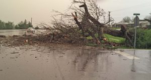
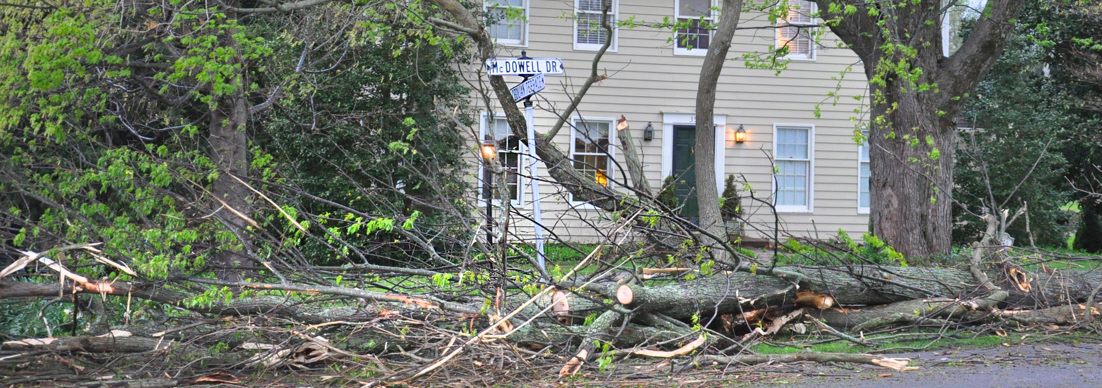
Photo courtesy Mike Wilder, Boyle County Emergency Management director
A tree blew down at the intersection of U.S. 127 south and Bonta Lane, south of Danville, during Wednesday night’s storm.
Boyle County was initially placed under a tornado watch at 2:50 p.m. Wednesday afternoon, to last until 11 p.m. A severe thunderstorm warning was issued at 6:52 p.m.
A tornado warning was issued at 7:09 p.m., and a second one was issued at 7:21 p.m. The warning lasted until 8 p.m.
“We were under a tornado warning for almost an hour. That is quite a bit,” Wilder said. “I’m sure we had winds in excess of 60 miles an hour.”
While the winds didn’t damage property, they did bring down trees and power lines. Reports of trees down came from Third Street in Perryville; U.S. 127 at Bonta Lane north of Junction City; and in northern Boyle County, along Ky. 34 at Gun Range Road, on Stoney Point Road and at Taylor Road.
There was also water over the Crawford Hollow Bridge on Crawford Hollow Road, between Mitchellsburg and Forkland in western Boyle County; and water flooded the underpass on Maple Avenue in Danville.
There was a large amount of lightning throughout the afternoon and evening on Wednesday. The lack of severe damage surprised Wilder.
“It looked like the Fourth of July. I’m just amazed, as much lightning as we had, that we did not have something, a structure of some kind, struck by lightning,” Wilder said. “I just knew it was going to be a lot worse than what it was.”
The Boyle County weather station that is part of the Kentucky Mesonet network recorded 1.22 inches of rainfall Wednesday, along with a maximum three-second wind gust speed of 49 miles per hour.
Wilder said snow flurries are actually predicted today, but no accumulation is expected. He said it is expected to be about 75 degrees on Sunday. No severe weather is anticipated in the near future, but that outlook isn’t firm.
“With all this instability in the atmosphere, there’s always going to be that chance,” he said. “They’re not speaking of anything severe at this point, but that can change.”
Follow Kendra Peek on Twitter, @knpeek.
More News


SportsPlus
How to Watch MLB Baseball on Friday, July 26: TV Channel, Live Streaming, Start Times
Today’s MLB slate has several top-tier games, including a matchup between the Cleveland Guardians and the Philadelphia Phillies.…
How to Watch the Reds vs. Rays Game: Streaming & TV Channel Info for July 26
The Cincinnati Reds and Rece Hinds hit the field at Tropicana Field against Randy Arozarena and the Tampa…
Reds vs. Rays: Betting Preview for July 26
When the Tampa Bay Rays (52-51) and Cincinnati Reds (49-53) match up in the series opener at Tropicana…
Tennessee Titans vs. Los Angeles Chargers Week 10 Tickets Available – Sunday, November 10 at SoFi Stadium
On Sunday, November 10, 2024, the Los Angeles Chargers (0-0) and the Tennessee Titans (0-0) clash at SoFi…
Tennessee Titans vs. New England Patriots Week 9 Tickets Available – Sunday, November 3 at Nissan Stadium
On Sunday, November 3, 2024, the New England Patriots (0-0) go head to head with the Tennessee Titans…
